LAWTON, OK — Lawton officials say the draft One Lawton Comprehensive Plan is a long-range guide for future land use and development decisions, not an immediate rezoning or property acquisition plan. But public reaction over the past week — both before and during a March 23 open house — shows that some residents view the plan as much more than that.
The draft plan, presented to City Council by consulting firm Garver, is intended to guide development in Lawton through 2050, combining land use, transportation, economic development, and quality of life priorities into a single long-range framework.
Public Concerns Emerged Before the Open House
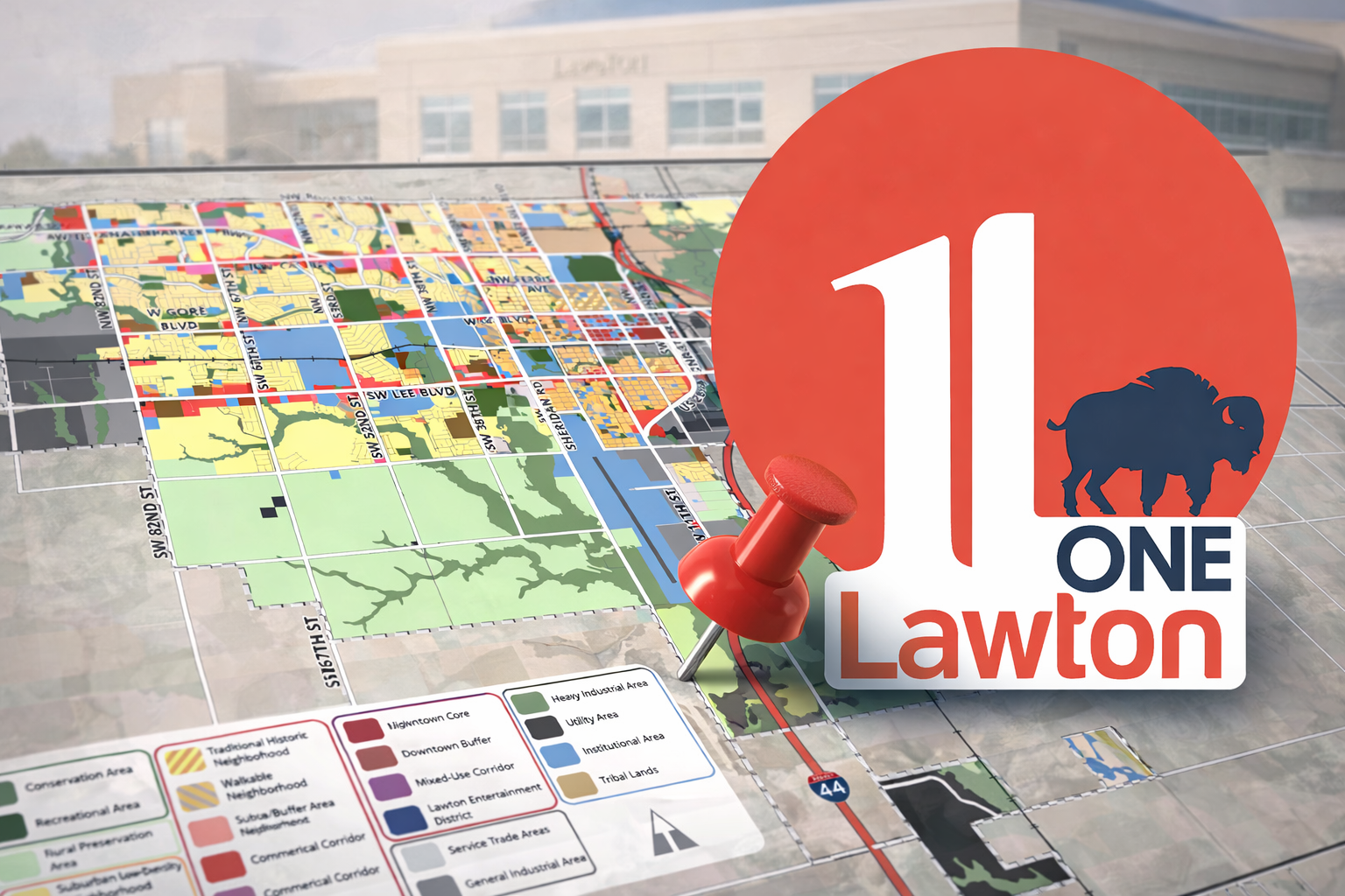
In a March 22 Sunday Evening Crier report, Lawton Town Crier highlighted the significance of the plan’s Future Land Use Map and raised early questions about transparency and access to supporting materials.
That report emphasized that while the map is not zoning itself, it often guides future zoning decisions and can shape how different parts of the city evolve over time.
It also identified that a document referenced in the plan — titled “Explanation of Plan Amendment” — did not appear to be publicly available, prompting an open records request.
A Long-Range Plan With Real Policy Implications
The One Lawton plan outlines how future development decisions should be evaluated, including whether proposed changes align with the City’s vision, impact infrastructure, affect surrounding properties, or set precedent for broader redevelopment in an area.
While the plan does not itself change zoning, it establishes the framework that future zoning requests and redevelopment efforts may be measured against.
Garver Presentation Emphasized Targeted Redevelopment
During the City Council presentation, Garver planner James Walden described the plan as an “all-in strategy” combining new growth with reinvestment in existing neighborhoods.
The plan includes tools such as Neighborhood Improvement Districts, housing incentives, redevelopment partnerships, and expanded use of federal housing programs.
In describing how those districts could function, Walden told council they would involve “really focused targeted code enforcement” paired with housing development incentives.
The draft plan further describes a proactive approach to code enforcement within designated areas and links those efforts to broader redevelopment strategies.
Open House Reveals Property Owner Concerns
At the March 23 public open house, several residents raised concerns about how the plan’s future land use designations could affect existing neighborhoods.
Property owners focused particularly on areas associated with redevelopment concepts and FISTA-related growth south of downtown.
One property owner said he owns multiple properties in a targeted area and questioned whether future designations could influence long-term investment decisions.
Another resident stated there is “no point having plans if you don’t plan to implement them,” capturing a broader concern that long-range planning can eventually translate into real-world action.
City staff repeatedly responded that the document is a land use plan — not a zoning change, not an acquisition plan, and not an urban renewal project.
However, residents continued to question how those distinctions would hold over time, particularly if future development proposals align with the plan’s mapped vision.
Land Use vs. Zoning: A Key Distinction — and Point of Tension
City staff emphasized that zoning changes require separate public hearings and formal approval processes, and that current zoning remains unchanged unless those steps occur.
At the same time, the plan itself indicates that future land use designations are intended to guide those later decisions.
That dual reality — that the plan does not directly change property rights, but may influence future decisions — was at the center of the discussion.
Records Requests Filed for Referenced Plan Documents and Map Data
As part of its reporting, Lawton Town Crier filed two open records requests related to the plan.
The first request seeks the document titled “Explanation of Plan Amendment,” which is referenced in the plan’s appendix but does not appear to be publicly available.
The second request seeks the underlying data used to create the Future Land Use (FLU) Map, including GIS files, CAD files, and supporting datasets used in its development.
These underlying materials can provide insight into how the plan was constructed, what assumptions were used, and how land use classifications were determined.
According to the City’s records system, the appendix request has been assigned for processing, while the request for map data has been sent for legal review.
Under the Oklahoma Open Records Act, records used in the transaction of public business are presumed open unless a specific exemption applies.
What Happens Next
The draft One Lawton Comprehensive Plan remains in the public comment phase and will return to the Planning Commission and City Council for further consideration.
City officials maintain the document is a long-range guide.
But public response — combined with ongoing records requests and review of supporting materials — suggests that for many residents, the plan is already shaping how they view the future of their neighborhoods.
Transparency Note
This story is based on the draft One Lawton Comprehensive Plan, agenda materials, the Garver presentation to City Council, the March 22, 2026 Sunday Evening Crier report, and public comments captured during the March 23, 2026 open house live stream. Additional reporting is based on open records requests filed with the City of Lawton.